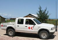
Banda Aceh - Calang v.v.8 uur over 180 km / 8 hours for 100 ml |

|
|
|
|
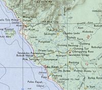
Deze pre-tsunami kaart stelt het makkelijk voor: |
 |
This pre-tsunami map makes things look easy: |
|
Wat meer detail: |
 |
Some more detail: |
|
Wie de nummering van de foto's goed bekijkt zal zien dat e.e.a. hier beslist niet op volgorde staat. Omdat we niet wisten wat ons te wachten stond en je niet overal kunt stoppen voor het nemen van foto's, heb ik de meeste plaatjes geschoten op de terugweg. Voor het verhaal maakt het niet veel uit. |
On close inspection one will find that the picture numbering is out of order. |
|
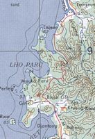
Na enig zoekwerk vond ik deze oude stafkaart op het web. Oud blijkt ook uit het feit dat Banda Aceh nog wordt aangegeven als Kutaradja. Maar prima voor mijn doel. |
 + 1 + 1
|
After some effort I found this old map on the Internet. Old is also implied by the fact that Banda Aceh is indicated with its old name Kutaradja. But it is fine for my purpose. |
|
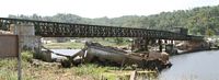
Dit is de rivier, met daarover een noodbrug, want de oorspronkelijke brug.... |
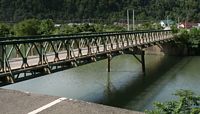 |
This is the river, with an emergency bridge, because the original bridge.... |
|
was een klein beetje weggespoeld. |
 |
has been swept away. |
|
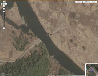
Die middenstreep staat er nog steeds en de donkere driehoek blijkt een stenen talud te zijn. |
 + 1 + 1
|
The centerline is still there and the dark triangle appears to be a stone slope. |
|
Na deze brug gaat de weg het kustgebergte in. De weg kronkelt, stijgt en daalt als een achtbaan, totdat we bij de rode ster zijn , Bineh Gle. Die ster is een uizichtspunt en laat daar nu net een koffietent staan. |
 |
After this bridge the road enters a coastal mountain range. It curves and bends like a roller-coaster, until we reach the red star, Bineh Gle. The star is a lookout point and as it turns out we find a coffee joint over there |
|
De blauwe tentjes links zijn de toiletten |
 + 3 + 3
|
The blue shelters on the left are the toilets |
|
Links naast de trappen staat aangegeven dat we van onderprovincie van Aceh wisselen |
 |
Left from the stairs is indicated that we cross into the next subdistrict of Aceh |
|
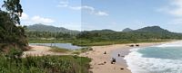
Als ik het door aardbevingen zwaar aangetaste uitzichtspunt beklim is dit het uitzicht naar het zuidoosten. De zwartgrauwe stranden zijn een voorbode van wat komen gaat. |
 + 3 + 3
|
When I climb up to the earthquake devastated lookout point, this is the view towards the southeast, the greyblack beaches are a premonition of things to come. |
|
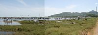
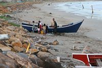
De veerpont bij Lam No |
The Ferry at Lam No |
|
Van de overkant komt iets aandobberen wat als het aanlegt.... |
 |
From the over side something floats our way, which as it comes ashore.... |
|
een pontje blijkt te zijn. |
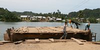 |
turns out to be a ferry |
|
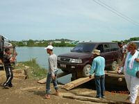
De eerste auto gaat erop, heus die balken zijn breed genoeg. |
 |
The first car boards, really those logs are wide enough. |
|
Zover mogelijk doorrijden a.u.b. er moet nog meer mee! |
 |
Go forward as far as possible please, there are more travelers |
|
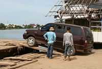
Komt u maar |
 |
Come please |
|
Goed zo, zo mogen we het zien, netjes aansluiten. |
 |
Now thats how we like it, no wasted space. |
|
Zie je wel, er is nog genoeg ruimte over achter de linker auto. |
 + 1 + 1
|
See: room to spare behind the car on the left. |
|
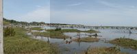
Dan start onze Rasta Captain de motor en gaan we varen. |
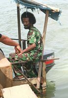 |
The the Afro captain starts the engine and we cast off. |
|
Dat deze buitenboordmotor niet voor dit soort werk geschikt is, is wel te zien aan het verschrikkelijke caviteren van de schroef. |
 |
That outboard engine is clearly not made for this job, as can be seen from the enormous cavitation of the propeller. |
|
Rivier met uitzicht: boven landinwaarts, beneden naar de kust |
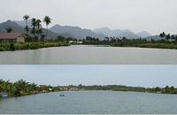 |
A river with a view: top land inward, bottom towards the coast |
|
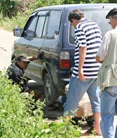
Kennelijk hebben we het gehaald |
 |
Apparently we made it |
|
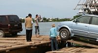
Die balk waarop je loopt ziet er behoorlijk stevig uit, nietwaar Conny? |
 + 2 + 2
|
That log you're walking on looks mighty strong , right Conny? |
|
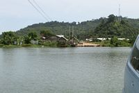
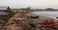
Na Lam No (zuidoostelijk) volgt er een kleine laagvlakte, dan weer een uitloper van bergen tot aan de kust, waarna er beneden Lho Kruet een vrij grote laagvlakte volgt die doorloopt tot voorbij Calang. In deze laagvlakte had de tsunami min of meer vrij spel.... |
 |
After Lam No (southeast) follows a small lowland, than an offshoot from the mountains, after which below Lho Kruet follows a real big lowland area,which runs all the way past Calang. In these lowlands there was nothing to stop the tsunami.... |
|
De oude kaart vermeldt hier: Coconut |
 |
Here the old map indicates: Coconut |
|
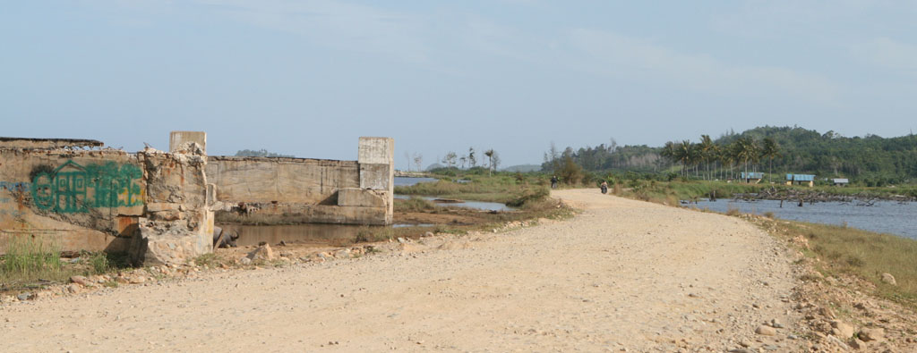
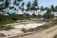
En dit is dus wat daar van over is |
 + 6 + 6
|
And this is what's left |
|
Dit kon dus niet uitblijven op deze weg |
 |
This was unavoidable on this road |
|
Maar het is goed te weten dat geestelijke steun nooit ver weg is. |
 |
But luckily spiritual support is alway close by. |
|
Een eind verderop zien we dat het, door het teruglopende tsunami water, weggespoelde zand door de zee wordt teruggebracht en er spontaan duinen aan het ontstaan zijn. |
 |
Further down the road we see that sand, swept away by the retreating tsunami wave, is brought back by the sea and sand dunes are forming. |
|
Inclusief stuifzand |
 |
Including drift-sand |
|
We stoppen hier om te kijken naar de boompjes op de achtergrond. Deze zijn door USAID aangeplant om het stuiven tegen te gaan, maar dreigen nu te verdrinken in het zand. |
 + 2 + 2
|
We stop to have a look at the small trees in the background. These were planted by USAID to reduce the drift-sand, but are now at risk to drown in the sand. |
|
Een andere noodbrug, nu bij .. |
 + 2 + 2
|
Another emergency bridge, this time at .. |
|
Naast de noodbrug aan de rivier ligt een van de kwekerijen, bij de rode tank rechtsboven. |
 |
Besides the bridge lies one of the greeneries, near the red tank at the right top. |
|
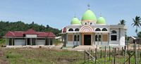
Ook in deze puinhoop is geestelijke hulp altijd dichtbij |
 + 4 + 4
|
In this mess also: spiritual support close by |
|
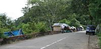
Een laatste stop voor Calang, met bamisoep en koffie |
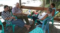 |
Last break before Calang, with noodle soup and coffee |
|
en een fraai uitzicht. |
 + 2 + 2
|
and a beautiful view. |
|
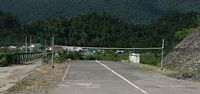
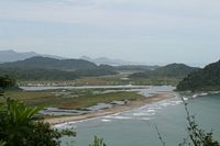
En dan Calang. |
 |
Finally Calang. |
|
Niet wetende dat Google ook hier prima vergelijkingsmateriaal heeft. |
 |
Not knowing that Google again has excellent comparison material. |
|
De andere lichtblauwe punt is ons hotel, waar deze auto voor staat. |
 |
The other light-blue dot is our hotel, in front of which this car is parked. |
|
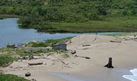
Stompjes van de bomen staan nog op het strand. |
 + 1 + 1
|
Tree roots are still standing on the beach. |
|
|
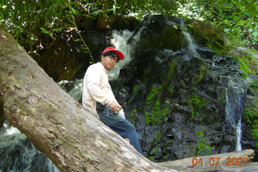
De dag na onze trip naar de bron gaan we weer terug naar Banda Aceh. |
 |
The day after our trip to the spring we head back to Banda Aceh. |
|
en dit noordwest. |
 |
and this is northwest. |
|
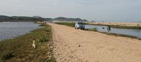
Dan maken we een stop bij Loh Kruet. |
 |
Next stop is at Loh Kruet |
|
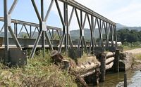
Geeft mij de tijd om deze noodbrug wat nader te bekijken |
 + 2 + 2
|
Gives me time to take a look at this emergency bridge |
|

|
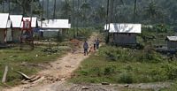
Als we wegrijden, zien we deze groep dorpsbewoners een pad herstellen.... |
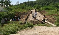 |
As we drive off, we see these villagers repairing a path.... |
|
met resten kapot koraal! |
 |
with shreds of broken coral! |
|
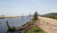
Een van de honderden kapotte bruggen, waar het water nu blijft is onduidelijk. |
 |
One of the hundreds broken bridges, where to the water flows now is unclear. |
|
Maar deze plek is illustratief voor de situatie: de weg is weg, we gaan hier linksaf landinwaarts, tot een plek waar de rivier smal genoeg is voor een noodbrug. Aan de andere kant kom je dan terug naar de kust. Dat deel van de weg is zichtbaar boven het water bij die twee telefoonpalen. |
 |
But this spot illustrates the situation: the road is gone, we turn left here inland, until we reach a spot where the river is small enough for an emergency bridge. On the other side one gets back to the coast. That part of the road can be seen above the water at those two telephone poles. |
|
Op een andere plek is de weg niet meer dan een karrenspoor zand om een rotspunt. |
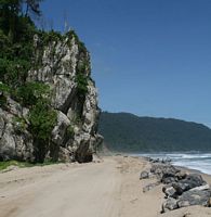 |
At another spot the road is a mere sand trail around a rock-edge. |